
Home › Routes › Bangalore to Munnar
Route · Kerala · From Bengaluru
Bangalore to Munnar: Distance, the Road and Every Way to Get There
Munnar is about 430 km from central Bengaluru by road. The fastest road does not go through Kochi: it runs south through Tamil Nadu by Hosur, Dharmapuri, Mettur and Tiruppur to Udumalaipettai, then climbs into Kerala past Chinnar and Marayoor. Here is the drive, the train-and-bus way in, what each costs, and where to stop.
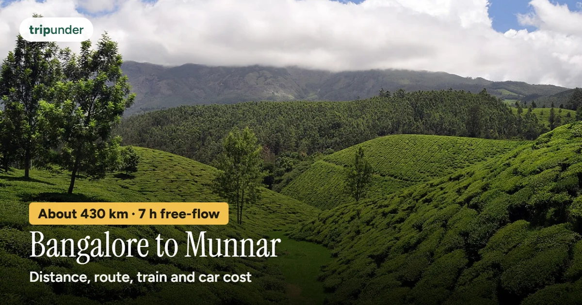
Photo: Raj, CC BY 2.0, via Wikimedia Commons. Text added by Trip Under.

Short answer
Bangalore to Munnar is about 430 km by road from the city centre, roughly 7 hours of driving on a clear road (6 h 56 min by OSRM's free-flow estimate; with traffic, meals and the ghat, plan on a long day). The road goes through Tamil Nadu, by Hosur, Tiruppur and Udumalaipettai, not through Kochi. There is no railway in Munnar: the usual public-transport way is a train to Ernakulam or Aluva, then a KSRTC bus up, 3 to 4.5 hours. We found no official fare for that bus, so check the live fare. Karnataka RTC also made a weekend overnight sleeper straight to Munnar permanent in 2024, ₹1,246 then, before the November 2026 fare revision. By your own car, petrol is about ₹3,200 one way.
How we worked it out. On 12 November 2026 we routed from central Bengaluru (12.9716, 77.5946) to Munnar town (10.0892, 77.0597, from Wikidata) with OpenStreetMap routing (OSRM), and looked up the towns at each turn of the route. Drive times from routing assume an empty road, so treat them as a floor. Fares come only from official notices or dated news reports; where we found none, we say so and give no number. Open the route on Google Maps for live traffic.
Every way to get there
| Way | Route | Time | Cost, one way | Source |
|---|---|---|---|---|
| Own car | 430 km via Hosur, Dharmapuri, Tiruppur, Udumalaipettai and Marayoor | 6 h 56 min free-flow | About ₹3,200 petrol; tolls not checked | Petrol ₹111.68/l in Bengaluru, 11 Nov 2026; 15 km/l assumed; OSRM, 12 Nov 2026 |
| Train + KSRTC bus | KSR Bengaluru → Ernakulam Jn (26651 Vande Bharat, arrives 13:50) or Aluva, then the bus up | train, then 3–4.5 h by bus | Check the live fare (no official or news fare found for either leg) | etrain, read 11 Nov 2026; bus times from our Vattavada page |
| Train to Kottayam + road | The 16526 from Bengaluru reaches Kottayam at 08:22; the road up goes via Thodupuzha, about 127 km | train, then about 2 h 20 min free-flow | Check the live fare | etrain and OSRM, 11 Nov 2026 (our Munnar guide) |
| Fly to Kochi + road | Bengaluru → Cochin airport, then about 104 km by road | flight, then about 1 h 55 min free-flow | Check the live fare | OSRM, 11 Nov 2026 (our Munnar guide) |
| KSRTC sleeper, direct (weekends) | Bengaluru (Shantinagar) → Munnar via Salem, Coimbatore, Pollachi and Udumalpet | about 13 h overnight | ₹1,246 in August 2024, before the Nov 2026 revision, so now more: check the live fare | Onmanorama, 26 Aug 2024; not confirmed running now |
- The car maths. 430.3 km ÷ 15 km a litre (our assumption for a petrol hatchback; yours will drop on the ghat) × ₹111.68 a litre = about ₹3,200. Split four ways, that is about ₹800 a person each way, before tolls.
- Tolls. The route uses national highways in Karnataka and Tamil Nadu, so expect toll plazas, but we could not check the amounts: the NHAI toll information site did not answer on 12 November 2026 and we found no dated report for this route. We give no toll figure.
- The direct bus. In August 2024 Karnataka RTC made its weekend non-AC sleeper to Munnar permanent: out of Bengaluru's Shantinagar terminal on Fridays at 21:11, about 13 hours via Salem, Coimbatore, Pollachi and Udumalpet, back from Munnar on Sundays at 17:08, for ₹1,246 (Onmanorama, 26 August 2024). We could not confirm it still runs, so check KSRTC's own booking site for your date.
- Bus fares went up on 5 November 2026. Karnataka raised KSRTC fares by about 23% on average (The South First, 4 November 2026), so the ₹1,246 figure is a pre-revision fare; expect more now. We found no fare published by Kerala KSRTC for its buses from Ernakulam or Aluva up to Munnar.
- Booking. Indian Railways and KSRTC sell their own tickets online and at the counter. Aggregators list the same buses with private ones; Trip Under does not link to them and takes no commission.
The road and where to stop
Infographic · the route
Bengaluru to Munnar by road
About 430 km. Distances and road names: OSRM, 12 Nov 2026.
OSRM's route leaves Bengaluru on Hosur Road (NH44) and reaches Hosur after about 43 km. It then takes NH844 through Rayakottai and rejoins NH44 on the Dharmapuri bypass at about 122 km. From there it turns south-west on NH544H, the Thoppur–Mettur–Bhavani road, past Mettur, crosses into Erode district near Bhavani, and runs by state roads through Tiruppur (about 283 km) and Palladam to Udumalaipettai (about 345 km). The last stretch, about 85 km, is the Udumalpet–Chinnar road to the Kerala border at Chinnar, then SH17 up through Marayoor into Munnar from the north.
- Udumalaipettai: the last town of any size before the hills, and the place to fill the tank and eat. From here to Munnar it is about 85 km, most of it a slow climb.
- Chinnar and Marayoor: the road crosses into Kerala at Chinnar and climbs through forest to Marayoor. Drive this stretch in daylight if you can: elephants, gaur and sambar move through the forest around Munnar in the early morning and evening (our Vattavada page).
- After Munnar: Devikulam and Eravikulam are next door (local bus about ₹20, about 20 minutes); Kolukkumalai for the sunrise (jeeps from Suryanelli (Kerala)); Meesapulimala (2 days, book through the forest agency); and Vattavada, 45 km past Munnar, our pick instead of Munnar.
This is a long day: about 7 hours of driving even on an empty road, and the last 85 km from Udumalaipettai are hill and forest. Leave Bengaluru early enough to do the Chinnar–Marayoor climb before dark.
When to go, and what a day there costs
Infographic · month by month
The Munnar hills, month by month
Month-by-month as text
Jan: Best · Feb: Best · Mar: Best · Apr: Good · May: Passable · Jun: Passable · Jul: Passable · Aug: Good · Sep: Good · Oct: Best · Nov: Best · Dec: Best
Trip Under's season scores for Devikulam and Eravikulam, 9 km from Munnar. September to March is clearest. Eravikulam closes annually, typically from February to March, for the tahr breeding season — check current dates before planning around it. The Neelakurinji flower blooms here once every twelve years across these hills.
Best months by our scores: Jan–Mar, Oct–Dec. On the ground, a day around Munnar costs about ₹1,200 on a shoestring, ₹2,200 mid-range and ₹4,500 comfortable, per person, with the bed, food, local transport and entry fees (Trip Under's Devikulam and Eravikulam rates; there is no separate Munnar page). See the Devikulam page for stays and the full plan.
Frequently asked questions
What is the distance from Bangalore to Munnar?
About 430 km by road from central Bengaluru to Munnar town (OSRM, 12 November 2026), via Hosur, Dharmapuri, Tiruppur and Udumalaipettai.
How long does it take to drive from Bangalore to Munnar?
About 6 hours 56 minutes on a clear road by OSRM's free-flow estimate. With city traffic, breaks and the climb from Udumalaipettai, expect a full day.
Which is the best route from Bangalore to Munnar?
The one OSRM picks: Hosur Road (NH44) to Hosur, NH844 via Rayakottai to Dharmapuri, NH544H via Mettur and Bhavani, then Tiruppur, Palladam and Udumalaipettai, and up past Chinnar and Marayoor. It does not go through Kochi.
Is there a train from Bangalore to Munnar?
Not all the way: Munnar has no railway station. Take a train to Ernakulam Junction (the 26651 Vande Bharat arrives at 13:50) or Aluva, about 109 km from Munnar, then a KSRTC bus or a taxi up. Our How to reach Munnar guide has every station.
Is there a direct bus from Bangalore to Munnar?
Karnataka RTC made a weekend non-AC sleeper permanent in August 2024: Fridays at 21:11 from Shantinagar, about 13 hours, ₹1,246 at the time (Onmanorama, 26 August 2024). That fare is from before the November 2026 revision and we could not confirm the bus still runs, so check the live fare. The other way is the train to Ernakulam or Aluva and a KSRTC bus up, 3 to 4.5 hours.
How much does it cost to drive from Bangalore to Munnar?
About ₹3,200 of petrol one way at ₹111.68 a litre (Bengaluru, 11 November 2026) and an assumed 15 km a litre. Tolls are extra; we could not check them.
What is the best time to visit Munnar from Bangalore?
Jan–Mar, Oct–Dec on Trip Under's season scores for the Munnar hills. September to March is clearest.
Sources and how we priced this
- Distance, drive time and roads: OSRM driving route (router.project-osrm.org) from Bengaluru (12.9716, 77.5946) to Munnar town (10.0892, 77.0597; Wikidata Q1025124, read 11 November 2026), 12 November 2026; towns from OpenStreetMap Nominatim reverse lookups at the route's turn points, 12 November 2026.
- Trains: etrain.info station lists for Ernakulam Jn, Aluva and Kottayam, read 11 November 2026; road distances from those stations and from Kochi airport: OSRM, 11 November 2026 (see our How to reach Munnar guide). Live times: NTES.
- Buses: Onmanorama, Karnataka RTC to make its weekend Bengaluru–Munnar service permanent (26 August 2024; fare from before the November 2026 revision, not confirmed running now); The South First, Karnataka bus fare revision from 5 November (4 November 2026). No fare published by Kerala KSRTC for Ernakulam or Aluva to Munnar was found, so none is given.
- Fuel and tolls: petrol price in Bengaluru, ₹111.68 a litre on 11 November 2026 (Upstox fuel price page); mileage of 15 km a litre is our assumption. NHAI TIS (tis.nhai.gov.in) did not respond on 12 November 2026, so tolls are not included.
- Bus times up the ghat, wildlife, local legs, season scores and daily rates: Trip Under's Devikulam and Vattavada pages, the Kolukkumalai and Meesapulimala trek pages, and our cost model.
- Photo: "Munnar Tea Plantation.jpg" by Raj, Wikimedia Commons, CC BY 2.0.
Keep reading
Go past Munnar
Vattavada is the farming valley at the end of the Munnar road: terraced fields, strawberries, cold nights and far fewer people. Buses, stays and costs on its page.
Open the Vattavada page →Fares and fuel prices are as read on the dates given and change often; check the live fare before you travel. Distances and drive times are routing estimates for a clear road. Daily costs come from Trip Under's place data and cost model (see methodology). Trip Under is not an agency and takes no commission on any booking.