
Home › Routes › Kochi to Munnar
Route · Kerala · From Kochi
Kochi to Munnar: Distance, Drive Time, Bus and Car Cost
How far Munnar is from Kochi, how long the road really takes, and every way up: the KSRTC bus, your own car or a cab, and the waterfalls and stops between the plains and the tea. Distances are measured from Ernakulam, Vyttila, Fort Kochi and the airport.
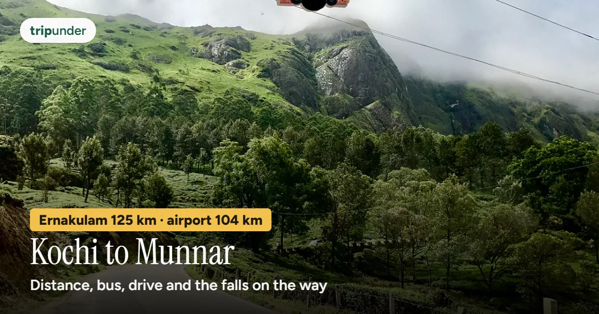
Photo: IM3847, CC BY-SA 4.0, via Wikimedia Commons. Text added by Trip Under.

Short answer
Munnar is about 125 km from Kochi by road, measured from the Ernakulam KSRTC bus station, and about 2 hours 10 minutes of driving on a clear road (OSRM free-flow estimate; allow 3 hours or more with traffic and the ghat). From Kochi airport it is about 104 km, roughly 1 hour 55 minutes. The cheapest way is the KSRTC bus from Ernakulam or Aluva, 3 to 4.5 hours, but we found no fare published by KSRTC or a dated news report, so check the live fare at the stand. The fastest way is a car or cab; fuel for your own car is about ₹940 one way at Ernakulam's petrol price and an assumed 15 km a litre.
There is no railway to Munnar, so from Kochi everyone goes by road: east across the plains to Muvattupuzha and Kothamangalam, then up the ghat from Neriamangalam into the Idukki hills. The question is only how: a state bus, your own car, or a cab.
How we worked it out. On 11 November 2026 we took coordinates for Munnar town and four Kochi starting points from Wikidata and routed each with OpenStreetMap routing (OSRM). The times are free-flow estimates: they assume an empty road, so treat them as the least the drive will take. Fuel is distance times a dated petrol price, divided by a mileage we assumed. Where we could not find an official or dated fare, we give none.
How far is Munnar from Kochi?
| Starting point in Kochi | Road distance to Munnar | Drive (free-flow estimate) |
|---|---|---|
| Ernakulam KSRTC bus station | about 125 km | about 2 h 10 min |
| Ernakulam Junction railway station | about 125 km | about 2 h 15 min |
| Vyttila Mobility Hub | about 120 km | about 2 h 5 min |
| Fort Kochi | about 132 km | about 2 h 20 min |
| Cochin International Airport (COK) | about 104 km | about 1 h 55 min |
Open the route in Google Maps directions for live traffic on the day.
Every way to get there
| Way | Time | Cost | Good to know |
|---|---|---|---|
| KSRTC bus, Ernakulam or Aluva → Munnar | 3–4.5 h | Check the live fare | Kerala's state buses run up several times a day (our Vattavada page). We found no fare published by KSRTC or a dated news report, so we give none. |
| Own car | about 2 h 10 min free-flow | about ₹944 fuel one way, ₹1,888 return | 124.7 km ÷ 15 km a litre (our assumption) × ₹113.53 a litre, Ernakulam petrol on 11 Nov 2026. Tolls not included: NHAI's toll site did not load when we checked. |
| Cab or taxi from Kochi | about 2 h 10 min free-flow | Check the live fare | We found no dated published fare, so get a quote for the full run, including waiting time. |
| Train + road | varies + about 2 h | Check the live fare | There is no station in Munnar. From Kochi a train does not help: the road from Aluva (about 109 km) or Ernakulam Junction (about 125 km) is the same climb. See our nearest-station guide. |
From the airport: fuel for the 104 km drive is about ₹784 at the same assumptions. We found no official direct bus from Kochi airport to Munnar; by public transport, go to Aluva, about 9 km away, and take a Munnar bus from there (our Munnar guide).
The road and where to stop
Infographic · the route
Kochi to Munnar by road
About 125 km. The plains end at Neriamangalam; after that it is a climb all the way.
From Ernakulam the road heads east on NH85 through Muvattupuzha and Kothamangalam to Neriamangalam, where the climb starts. From there OSRM's fastest line on 11 November 2026 left NH85 and went up by the state highway via Kallarkutty, rejoining the Munnar road near the top. The classic NH85 line, past Cheeyappara and Valara falls and through Adimali, came out about the same distance, about 124 km, and about 10 minutes slower on its estimate. Either way, allow more time than the routing says.

Photo: Augustus Binu : flickr : Instagram, CC BY-SA 3.0, via Wikimedia Commons

- Chottanikkara (before you leave Kochi): the Devi temple at Chottanikkara is about 20 km from Kochi, a short detour off the start of the route. It is the first stop of our Chottanikkara and Kodungallur circuit.
- Cheeyappara and Valara falls: both are on the Kochi–Madurai highway between Neriamangalam and Adimali, and Cheeyappara comes down in seven steps (Kerala Tourism). They are on the NH85 line, so if you want them, go via Adimali, not the faster-routed state highway. Cheeyappara sits right by the road; park where it is safe.
- Adimali: the last town of any size before Munnar on the NH85 line, about 24 km short of Munnar town by road (OSRM).
- After Munnar: Devikulam and Eravikulam are next door (local bus about ₹20, about 20 minutes); Kolukkumalai for the sunrise (jeeps from Suryanelli (Kerala)); Meesapulimala (2 days, book through the forest agency); and Vattavada, 45 km past Munnar, our pick instead of Munnar.
Drive the forest stretches in daylight if you can. Elephants, gaur and sambar move through the forest around Munnar in the early morning and evening (our Vattavada page).
KSRTC buses up
- From Ernakulam and Aluva: several KSRTC buses a day, 3 to 4.5 hours (our Vattavada page). Aluva is closer to Munnar and to the airport; Ernakulam is closer if you are staying in the city.
- Fare: we could not find a fare published by KSRTC itself or in a dated news report, so we give no number. Ask at the stand or check KSRTC's own booking site for your date.
- Night buses down: in February 2026 KSRTC announced a Munnar–Thiruvananthapuram Super Fast via Kottayam, leaving Munnar at 03:00 (Onmanorama, 3 February 2026). The report said it would be launched shortly; we could not confirm it is running.
When to go and what Munnar costs a day
Infographic · month by month
The Munnar hills, month by month
Month-by-month as text
Jan: Best · Feb: Best · Mar: Best · Apr: Good · May: Passable · Jun: Passable · Jul: Passable · Aug: Good · Sep: Good · Oct: Best · Nov: Best · Dec: Best
Trip Under's season scores for Devikulam and Eravikulam, 9 km from Munnar. Best: Jan–Mar, Oct–Dec. September to March is clearest. Eravikulam closes annually, typically from February to March, for the tahr breeding season — check current dates before planning around it. The Neelakurinji flower blooms here once every twelve years across these hills.
| Style | Per person, per day on the ground |
|---|---|
| Shoestring | ₹1,200 |
| Mid-range | ₹2,200 |
| Comfortable | ₹4,500 |
So a two-day mid-range trip from Kochi by your own car comes to roughly ₹6,300 for one person (two days on the ground plus fuel both ways, before tolls), and less each if you share the car.
Frequently asked questions
What is the distance from Kochi to Munnar?
About 125 km by road from the Ernakulam KSRTC bus station, about 120 km from Vyttila Mobility Hub, about 132 km from Fort Kochi and about 104 km from Cochin International Airport (OSRM, 11 November 2026).
How long does it take to drive from Kochi to Munnar?
About 2 hours 10 minutes from Ernakulam on a clear road, by OSRM's free-flow estimate, and about 1 hour 55 minutes from the airport. With traffic, the ghat and a stop, plan on 3 hours or more.
What is the cheapest way from Kochi to Munnar?
The KSRTC state bus from Ernakulam or Aluva, 3 to 4.5 hours. We found no fare published by KSRTC or in a dated news report, so check the live fare at the stand.
Is there a train from Kochi to Munnar?
No. Munnar has no railway station. The nearest useful stations, Aluva (about 109 km) and Ernakulam Junction (about 125 km), are in Kochi itself, so from Kochi you go by road anyway.
Which is the best route from Kochi to Munnar?
NH85 east through Muvattupuzha, Kothamangalam and Neriamangalam, then the ghat. Past Neriamangalam you can stay on NH85 via Cheeyappara and Valara falls and Adimali, or take the state highway via Kallarkutty that OSRM picked; both were about 124–125 km on 11 November 2026.
How much is fuel from Kochi to Munnar?
About ₹944 one way and ₹1,888 return for 125 km at ₹113.53 a litre (Ernakulam, 11 November 2026) and an assumed 15 km a litre. Tolls are not included.
When is the best time to go to Munnar?
Jan–Mar, Oct–Dec on Trip Under's season scores for the Munnar hills. September to March is clearest.
Sources and how we priced this
- Coordinates: Wikidata, Munnar (Q1025124), Ernakulam KSRTC Bus Station (Q141301531), Ernakulam Junction (Q5392599), Vyttila Mobility Hub (Q7944049), Cochin International Airport (Q592172), Cheeyappara Waterfalls (Q38335), Valara Waterfalls (Q135487666), read 11 November 2026.
- Road distances, free-flow times and the towns on the route: OSRM driving routes (router.project-osrm.org), 11 November 2026; the NH85 line was routed with Cheeyappara as a via point.
- Petrol: Goodreturns, petrol price in Ernakulam, ₹113.53 a litre on 11 November 2026. Mileage of 15 km a litre is Trip Under's assumption. Tolls: NHAI's toll information site (tis.nhai.gov.in) did not respond on 11 November 2026, so none are included.
- Waterfalls: Kerala Tourism, Cheeyappara page (keralatourism.org/munnar/cheeyappara-munnar.php), read 12 November 2026.
- Buses: KSRTC Munnar–Thiruvananthapuram Super Fast, Onmanorama (3 February 2026; announced, not confirmed running). No official KSRTC fare for Ernakulam or Aluva to Munnar was found, so none is given. These reuse the sources of our How to reach Munnar guide (read 11 November 2026).
- Bus times, local legs, wildlife, season scores and daily rates: Trip Under's Devikulam and Vattavada pages, the Kolukkumalai and Meesapulimala trek pages and the Chottanikkara circuit.
Keep reading
Go past Munnar
Vattavada is the farming valley at the end of the Munnar road: terraced fields, strawberries, cold nights and far fewer people. Buses, stays and costs on its page.
Open the Vattavada page →Distances and drive times are OpenStreetMap routing estimates for a clear road, not promises; the ghat, traffic and weather add time. Fuel is our own sum with an assumed mileage. Daily costs come from Trip Under's place data and cost model (see methodology). Check live bus times and fares before you travel. Trip Under is reader-planned, not an agency, and takes no commission on any booking.