
Home › Routes › Madurai to Kodaikanal
Route · Tamil Nadu · From Madurai
Madurai to Kodaikanal: Distance, the Two Ghat Roads, Bus and Car
Madurai is the nearest airport and the nearest big bus stand to Kodaikanal, and the hill town is a long morning's climb away. The road crosses the plain to Batlagundu, then climbs one of two ghat roads into the Palani hills. Here is how far it is, how long it takes, the bus, and what the drive costs.
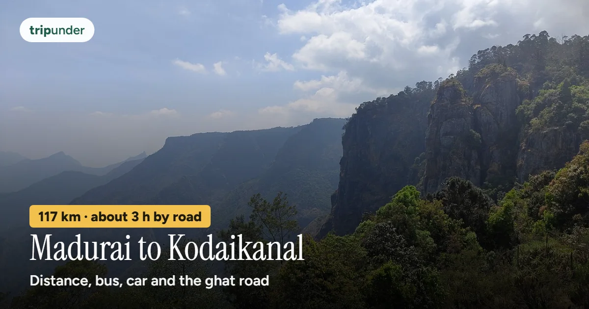
Photo: రవిచంద్ర, CC BY-SA 4.0, via Wikimedia Commons. Text added by Trip Under.

Short answer
Kodaikanal is about 117 km from Madurai by road, measured to the lake, by the main ghat road through Batlagundu, and about 3 hours 5 minutes of driving on a clear road (OSRM free-flow estimate). OSRM's fastest line is a little longer, about 128 km in about 2 hours 40 minutes, up the narrower Adukkam road. There is no train: the direct bus from Madurai is the cheap way, about 3 to 3¼ hours; we found no official or dated fare, so check the live fare. By your own car, fuel is about ₹850 one way at Madurai's petrol price and an assumed 15 km a litre.
Kodaikanal sits on a plateau high in the Palani hills. From Madurai the first 60 km or so is flat country north-west to Batlagundu, at the foot of the hills; the second half is all hairpins, forest and mist, ending at the lake.
How we worked it out: on 12 November 2026 we routed Madurai (Wikidata, 9.9197, 78.1194) to the Kodaikanal lake point in our place data (10.24, 77.49) with OpenStreetMap routing (OSRM). OSRM's fastest route takes the Adukkam road, so we also forced a point on the main Kodai Ghat Road to measure the usual climb. The times are free-flow estimates: they assume an empty road. Where we could not find an official or dated fare, we give none.
How far is Kodaikanal from Madurai?
| Road | Road distance to Kodaikanal lake | Drive (free-flow estimate) |
|---|---|---|
| Main ghat road (SH156) via Batlagundu | about 117 km | about 3 h 5 min |
| Adukkam road (MDR1168) via Batlagundu | about 128 km | about 2 h 40 min |
| Madurai Junction, by OSRM's fastest route | about 127 km | about 2 h 40 min |
The main road is shorter but slower on the routing estimate because of the long climb. Open the route in Google Maps directions for live traffic on the day.
Every way to get there
| Way | Time | Cost | Good to know |
|---|---|---|---|
| Bus, Madurai → Kodaikanal | about 3–3¼ h | Check the live fare | Direct buses leave from Madurai; an aggregator listed 18 a day in January 2026 (via our Kodaikanal by train guide). We found no official TNSTC fare or dated news fare, so we give none. |
| Own car, main ghat road | about 3 h 5 min free-flow | about ₹845 fuel one way, ₹1,690 return | 116.8 km ÷ 15 km a litre (our assumption) × ₹108.50 a litre, Madurai petrol on 11 Nov 2026. Tolls were not checked, so none are included. |
| Own car, Adukkam road | about 2 h 40 min free-flow | about ₹923 fuel one way | 127.6 km at the same price and mileage. A narrower second ghat road; we did not check its current condition, so ask locally before you take it. |
| Cab or taxi | about 3 h free-flow | Check the live fare | We found no dated published fare. Agree the fare, any tolls and the sightseeing loop at the top before you leave. |
| Train | not possible | — | Kodaikanal has no railway. Kodai Road station is on the Madurai–Dindigul line and 88 km from Kodaikanal, so from Madurai the direct bus or car is simpler. |
Flying in? Madurai (IXM) is the nearest airport to Kodaikanal; our Kodaikanal page plans about 3½ hours by road from it. Coming by train from Chennai or Bengaluru, our Kodaikanal by train guide explains Kodai Road, Dindigul and Palani.
The road and where to stop
Infographic · the route
Madurai to Kodaikanal by road
About 117 km by the main ghat road. Distances and road names: OSRM, 12 Nov 2026.
OSRM's route on 12 November 2026 leaves Madurai north towards Sholavandan and joins the NH44 four-lane towards Dindigul past Vadipatti, then turns west on the Ammaianaikanur–Vathalagundu road (Ammaianaikanur is the town at Kodai Road station) to Batlagundu (Vathalagundu) at the foot of the hills, about 60 km in. From there the main road is the Kodai Ghat Road (SH156), about the last 45 km to the lake. OSRM's faster line instead runs on along the Dindigul–Theni road (NH183) towards Devadanapatti and climbs by the Periyakulam–Adukkam–Kodaikanal road; both meet the same Kodai Ghat Road for the last stretch into town.
- Batlagundu: the last town on the plain and the natural tea stop before the climb. Fill up here if you are driving.
- Silver Cascade falls: a roadside waterfall beside the Kodai Ghat Road near the top (OpenStreetMap).
- At the top: cycle the lake (about 1 h 30 m), Coaker's Walk at dawn (₹30), Pillar Rocks & Guna Cave on the taxi loop, and the Dolphin's Nose & Echo Point walk from Vattakanal (about 3 h, free), all from our Kodaikanal page.
- Madurai before you go: the Meenakshi temple and Madurai's food. If you are doing the south as a loop, Rameswaram is the other way: see Madurai to Rameswaram.
The ghat road closes for landslips in heavy monsoon, sometimes for days (our Kodaikanal page). From June to August check the road before you set off, and drive the climb in daylight.
When to go and what Kodaikanal costs a day
Infographic · month by month
Kodaikanal month by month
Month-by-month as text
Jan: Good · Feb: Good · Mar: Good · Apr: Good · May: Passable · Jun: Passable · Jul: Passable · Aug: Good · Sep: Best · Oct: Best · Nov: Best · Dec: Best
Trip Under's season scores. Best: Sep–Dec. September to March is the window — clear, cold at night, and green. April and May are busy with domestic holidaymakers; June to August brings heavy rain and landslips on the ghat road.
| Style | Per person, per day on the ground |
|---|---|
| Shoestring | ₹1,000 |
| Mid-range | ₹1,700 |
| Comfortable | ₹3,400 |
So a two-day mid-range trip from Madurai by your own car comes to roughly ₹5,100 for one person (two days on the ground plus fuel both ways, before tolls). By bus it is mostly the ₹3,400 on the ground, plus the bus fare.
Frequently asked questions
What is the distance from Madurai to Kodaikanal?
About 117 km by road from Madurai city centre to Kodaikanal lake by the main ghat road via Batlagundu, or about 128 km by the Adukkam road (OSRM, 12 November 2026).
How long does it take from Madurai to Kodaikanal?
About 3 hours 5 minutes of driving on a clear road by the main ghat road, or about 2 hours 40 minutes by the Adukkam road, on OSRM's free-flow estimates. Buses take about 3 to 3¼ hours (aggregator, January 2026).
What is the cheapest way from Madurai to Kodaikanal?
The direct bus from Madurai. We found no official TNSTC fare or dated news fare for it, so check the live fare at the bus stand or on the operator's site.
Is there a train from Madurai to Kodaikanal?
No. Kodaikanal has no railway. Kodai Road station is 88 km from Kodaikanal, so from Madurai the direct bus or car is simpler. Our Kodaikanal by train guide covers the stations for trips from Chennai and Bengaluru.
Which is the best road from Madurai to Kodaikanal?
NH44 towards Dindigul past Vadipatti, west to Batlagundu, then the Kodai Ghat Road (SH156), about 117 km. OSRM rates the Adukkam road faster, but it is narrower; ask locally about its condition.
How much does it cost to drive from Madurai to Kodaikanal?
About ₹845 of petrol one way by the main ghat road at ₹108.50 a litre (Madurai, 11 November 2026) and an assumed 15 km a litre. We did not check tolls.
When is the best time to visit Kodaikanal?
Sep–Dec on Trip Under's season scores. April and May are busy, and June to August brings heavy rain and landslips on the ghat road.
Sources and how we priced this
- Coordinates: Wikidata, Madurai (Q228405), read 11 November 2026; Kodaikanal lake point (10.24, 77.49) from Trip Under's place data; Batlagundu and Silver Cascade Falls from OpenStreetMap Nominatim, 12 November 2026.
- Road distances, free-flow times and road names: OSRM driving routes (router.project-osrm.org), 12 November 2026: fastest route 127.6 km via the Periyakulam–Adukkam–Kodaikanal road; main ghat route 116.8 km via a point on the Kodai Ghat Road (SH156). Madurai Junction to Kodaikanal and Kodai Road station to Kodaikanal: OSRM, 5 November 2026, in our Kodaikanal by train guide.
- Buses: frequency and journey time from an aggregator (coachbuildersindia, January 2026), as quoted in our Kodaikanal by train guide. No official TNSTC fare or dated news fare was found for Madurai–Kodaikanal, so none is given.
- Petrol: Goodreturns, petrol price in Madurai, ₹108.50 a litre on 11 November 2026. Mileage of 15 km a litre is Trip Under's assumption. Tolls were not checked.
- Stops, ghat closures, season scores and daily rates: Trip Under's Kodaikanal page and our cost model.
- Photo: "Pillar Rocks, Kodaikanal Hills" by రవిచంద్ర (Ravichandra), Wikimedia Commons, CC BY-SA 4.0.
Keep reading
Price your Kodaikanal trip
Set your days, family size and style on the Kodaikanal page and see the bus, rooms and meals add up.
Open the Kodaikanal page →Distances and drive times are OpenStreetMap routing estimates for a clear road, not promises; the ghat climb takes longer with traffic. Fuel is our own sum with an assumed mileage. Daily costs come from Trip Under's place data and cost model (see methodology). Check live bus fares and any ghat road closures before you travel. Trip Under is reader-planned, not an agency, and takes no commission on any booking.