
Home › Routes › Madurai to Rameswaram
Route · Tamil Nadu · From Madurai
Madurai to Rameswaram: Distance, Train over the New Pamban Bridge, Bus and Car
Rameswaram is on an island, and both ways in cross the sea at Pamban: the road over the 1988 road bridge, and the railway over the new vertical-lift bridge that opened in April 2025. Here is how far it is from Madurai, how long it takes, the trains, the buses, and what the drive costs.
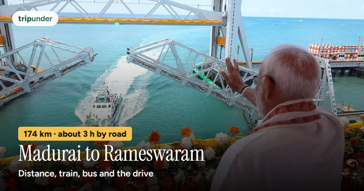
Photo: Vijaya nanthini, CC0, via Wikimedia Commons. Text added by Trip Under.

Short answer
Rameswaram is about 174 km from Madurai by road, measured to the Ramanathaswamy temple, and about 2 hours 55 minutes of driving on a clear road (OSRM free-flow estimate) on NH87 through Paramakudi and Ramanathapuram and over the Pamban road bridge. The cheapest way is the unreserved passenger train: three a day, about 3½ to 4 hours, over the new Pamban rail bridge. We found no official or recent dated fare for it or for the bus, so check the live fare. The fastest way is your own car or a cab; fuel is about ₹1,260 one way at Madurai's petrol price and an assumed 15 km a litre.
The Madurai–Rameswaram road and railway run side by side across the dry Ramanathapuram plain and meet the sea at Mandapam. From there the road goes over the 2.3 km Pamban road bridge and the trains over the new lift bridge beside it. It is one of the few places in India where the train is both the cheapest and the best way to arrive.
Gokul, who runs Trip Under, is from Rameswaram. How we worked it out: on 11 November 2026 we took coordinates for Madurai, its bus terminus and airport, and the Ramanathaswamy temple from Wikidata and routed them with OpenStreetMap routing (OSRM). The times are free-flow estimates: they assume an empty road. Train times are from etrain, read on 12 November 2026; check NTES before you travel. Where we could not find an official or dated fare, we give none.
How far is Rameswaram from Madurai?
| From | Road distance to Rameswaram temple | Drive (free-flow estimate) |
|---|---|---|
| Madurai city centre | about 174 km | about 2 h 55 min |
| Mattuthavani bus terminus | about 176 km | about 2 h 55 min |
| Madurai airport (IXM) | about 180 km | about 3 h 5 min |
| By rail, Madurai Jn to Rameswaram | 161 km of track | 3 h 25 min (train 56711) |
Open the route in Google Maps directions for live traffic on the day.
Every way to get there
| Way | Time | Cost | Good to know |
|---|---|---|---|
| Passenger train, Madurai Jn → Rameswaram | 3 h 25 min to 3 h 45 min | Check the live fare | Three a day, unreserved: 56711 leaves 07:00 (arrives 10:25), 56713 13:00 (16:45), 56715 18:30 (22:15). Back: 56712 05:45, 56714 11:45, 56716 18:20. Rameswaram station is in town, close to the temple. |
| TNSTC bus, Madurai → Rameswaram | about 3–4 h | Check the live fare | Government and private buses run from Madurai; our Rameswaram data lists TNSTC buses several times daily. We found no official fare, and the newest news fare we found is from 2018, so we give none. |
| Own car | about 2 h 55 min free-flow | about ₹1,257 fuel one way, ₹2,514 return | 173.8 km ÷ 15 km a litre (our assumption) × ₹108.50 a litre, Madurai petrol on 11 Nov 2026. Tolls not included: NHAI's toll site did not load when we checked. |
| Cab or taxi | about 2 h 55 min free-flow | Check the live fare | We found no dated published fare. Agree the fare, tolls and the Dhanushkodi run before you leave. |
Coming from Chennai? You do not need to change at Madurai: overnight trains such as the 16751 and 22661 run straight to Rameswaram over the bridge. Our Rameswaram trip cost guide has the full budget.
The Pamban bridges: road and rail

Photo: Vensatry, CC BY-SA 3.0, via Wikimedia Commons

- The train: the new Pamban rail bridge is open. India's first vertical-lift sea bridge was opened on 6 April 2025. It is about 2.08 km long, with a 72.5 m span that lifts up to 17 m to let ships through (DT Next, 7 April 2025). On 12 November 2026 etrain listed 36 trains at Rameswaram station, including the three daily Madurai passengers, so trains are running onto the island. Check NTES on the day for any suspension.
- The road: the Pamban road bridge. The Annai Indira Gandhi road bridge, opened in 1988, is about 2.3 km long and is the only road link between Rameswaram island and the mainland, on NH87. In July 2026 NHAI floated a tender for its repair: concrete restoration, crack sealing, a new road surface and new railings, to be finished within 12 months of the award (Construction World, 20 July 2026). The report did not mention closures, but repair work can bring lane restrictions, so allow extra time.
- Stop on the road bridge? Watching a train cross the sea from the Pamban side is one of the island's sights (our data lists the Pamban bridge viewpoint, about 1 h). Time it with the train timetable.
The road and where to stop
Infographic · the route
Madurai to Rameswaram by road
About 174 km. The road bypasses Thiruppuvanam and Manamadurai and runs past Paramakudi and Ramanathapuram.
OSRM's route on 11 November 2026 leaves Madurai along the Vaigai and takes NH87 for about 128 km of the way, bypassing Thiruppuvanam and Manamadurai, past Paramakudi and Ramanathapuram, to the coast at Mandapam and over the Pamban road bridge onto the island. The railway runs alongside, through Manamadurai, Paramakudi, Ramanathapuram, Mandapam and Pamban (etrain).
- Madurai before you go: the Meenakshi temple and Madurai's food are the first half of our Rameswaram and Madurai circuit (3 days · 2 nights). Thiruparankundram, one of Murugan's six abodes, is on the edge of Madurai: see the Arupadai Veedu circuit.
- Pamban: the bridges, and the viewpoint for a train crossing the sea (above).
- Ariyaman and Kunthukal beaches: about 25 km from Rameswaram by local bus, about ₹40 (our Rameswaram page).
- Dhanushkodi, past the end of the road: about 23 km beyond the temple by road (OSRM). Allow a half day for the 1964 cyclone ruins; take the local bus, about ₹25 per our data, rather than a taxi.
When to go and what Rameswaram costs a day
Infographic · month by month
Rameswaram month by month
Month-by-month as text
Jan: Best · Feb: Best · Mar: Good · Apr: Passable · May: Avoid · Jun: Avoid · Jul: Passable · Aug: Passable · Sep: Good · Oct: Best · Nov: Best · Dec: Best
Trip Under's season scores. Best: Jan–Feb, Oct–Dec. October to March is comfortable. April to June on the island is brutal — there is no shade and the heat comes off the water. October to December can bring cyclone weather.
| Style | Per person, per day on the ground |
|---|---|
| Shoestring | ₹800 |
| Mid-range | ₹1,300 |
| Comfortable | ₹2,600 |
So a two-day mid-range trip from Madurai by your own car comes to roughly ₹5,100 for one person (two days on the ground plus fuel both ways, before tolls). By the passenger train it is mostly the ₹2,600 on the ground.
Frequently asked questions
What is the distance from Madurai to Rameswaram?
About 174 km by road from Madurai city centre to the Ramanathaswamy temple, and about 176 km from Mattuthavani bus terminus (OSRM, 11 November 2026). By rail it is 161 km from Madurai Junction.
How long does it take from Madurai to Rameswaram?
About 2 hours 55 minutes of driving on a clear road by OSRM's free-flow estimate. The passenger trains take 3 hours 25 minutes to 3 hours 45 minutes, and buses about 3 to 4 hours.
What is the cheapest way from Madurai to Rameswaram?
The unreserved passenger train, three a day each way. We found no official or recent dated fare for it or for the bus, so check the live fare at the station or on the operator's site.
Is there a train from Madurai to Rameswaram now?
Yes. Trains cross to the island over the new Pamban rail bridge, opened on 6 April 2025. Three daily passengers run from Madurai: 56711 at 07:00, 56713 at 13:00 and 56715 at 18:30 (etrain, 12 November 2026). Check NTES for weather suspensions.
Which is the best road from Madurai to Rameswaram?
NH87 via Paramakudi and Ramanathapuram, then the Pamban road bridge, about 174 km. The road bridge is the only road onto the island; NHAI tendered its repair in July 2026, so allow extra time in case of lane restrictions.
Can I drive to Dhanushkodi from Rameswaram?
The road runs about 23 km from the temple towards Dhanushkodi (OSRM). Police close it during rough-sea alerts, so go in the morning and check locally.
When is the best time to visit Rameswaram?
Jan–Feb, Oct–Dec on Trip Under's season scores. April to June is very hot on the island, and October to December can bring cyclone weather.
Sources and how we priced this
- Coordinates: Wikidata, Madurai (Q228405), Mattuthavani Bus Terminus (Q12987115), Madurai International Airport (Q3465662), Ramanathaswamy Temple (Q14565670), Paramakudi (Q2719694), Ramanathapuram (Q775255), Pamban (Q7129068), read 11 November 2026.
- Road distances, free-flow times and the towns on the route: OSRM driving routes (router.project-osrm.org), 11 November 2026.
- Trains: etrain.info, Rameswaram (RMM) station list (36 trains) and the schedules of 56711, 56713 and 56715, read 12 November 2026. Live times: NTES.
- New Pamban rail bridge: DT Next, "India's first vertical lift sea bridge opens in Tamil Nadu: here are 15 facts to know" (7 April 2025). Pamban road bridge: Construction World, "NHAI floats tender for strengthening Pamban road bridge" (20 July 2026).
- Petrol: Goodreturns, petrol price in Madurai, ₹108.50 a litre on 11 November 2026. Mileage of 15 km a litre is Trip Under's assumption. NHAI's toll information site (tis.nhai.gov.in) did not respond on 11 November 2026, so no tolls are included.
- Fares: no official or recent dated fare was found for the Madurai–Rameswaram bus or passenger train. The newest news figure we found (DT Next, January 2018) is too old to use.
- Stops, season scores and daily rates: Trip Under's Rameswaram page, the Rameswaram and Madurai circuit and the Arupadai Veedu circuit. Dhanushkodi closures and the Chennai trains: our Rameswaram trip cost guide.
Keep reading
Price your Rameswaram trip
Set your days, family size and style on the Rameswaram page and see the trains, rooms and meals add up.
Open the Rameswaram page →Distances and drive times are OpenStreetMap routing estimates for a clear road, not promises. Fuel is our own sum with an assumed mileage. Daily costs come from Trip Under's place data and cost model (see methodology). Check live train and bus fares and any weather suspensions before you travel. Trip Under is reader-planned, not an agency, and takes no commission on any booking.